

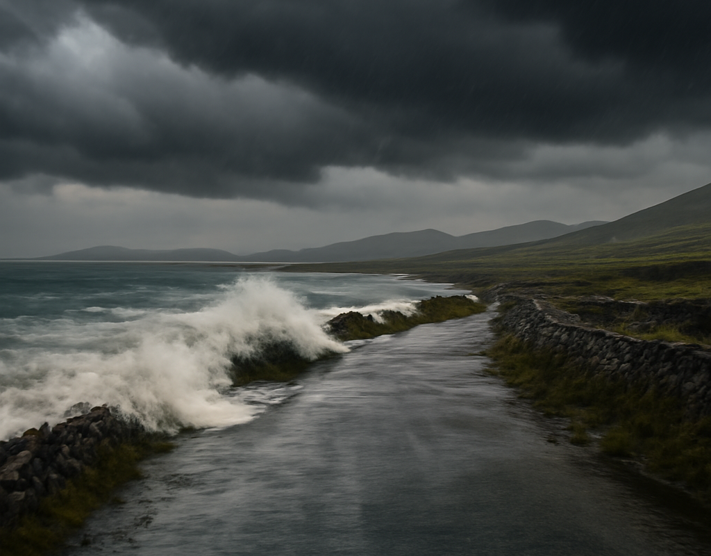
Storm Boelo is bringing heavy rain, damaging winds and a heightened risk of flooding to parts of Ireland, with Status Orange warnings in force for Galway and Kerry. The storm is arriving shortly after Storm Austen left already saturated ground and elevated river levels across several areas.
Met Éireann has warned of difficult conditions across western and southern counties, while transport disruption has already begun. People living in affected areas should monitor official updates, avoid unnecessary travel and never drive through floodwater.
Storm Boelo brings orange weather warnings to western Ireland
The Status Orange rain warning for Galway and Kerry began at 7am on Saturday and remains valid until 2pm. Met Éireann says flooding is expected, with possible damage to homes and businesses.
A further Status Orange wind warning is scheduled for Galway, Donegal, Mayo, Leitrim and Sligo from 2pm Saturday until 9am Sunday. Gale-force westerly winds may produce severe and damaging gusts during that period.
The combination of intense rainfall, strong winds, high tides and saturated ground is creating a complex weather threat. Coastal communities face a particular risk of flooding, while inland locations may also experience surface-water flooding and rapidly rising rivers.
Where Status Yellow warnings apply
Met Éireann has also issued several Status Yellow alerts:
- A rain warning for Clare, Cork, Donegal, Leitrim, Limerick, Mayo, Sligo and Galway, valid until 3pm Saturday.
- A wind warning for Connacht, Clare, Kerry and Limerick, in force from 1pm until midnight.
- A wind warning for Donegal, valid from 1pm Saturday until 3pm Sunday.
- A wind warning for Cavan and Monaghan, valid from 6pm Saturday until midday Sunday.
Warning times can change as conditions develop. Residents should check the latest Met Éireann guidance before travelling or making plans outdoors.
Flooding risk rises after Storm Austen
Storm Boelo follows Storm Austen, which brought heavy rain on Thursday night. As a result, the ground is saturated in many areas and river levels are already high.
Additional rainfall may run off quickly rather than soaking into the soil. Met Éireann has highlighted the possibility of rapid runoff, rising river levels, surface-water accumulation and river flooding, particularly in the west and southwest.
High tides could make conditions worse in coastal counties. Even areas outside the main warning zones may see localised flooding if drainage systems become overwhelmed or rivers respond quickly to further rain.
- Check official weather and flood updates before travelling.
- Do not walk or drive through floodwater.
- Secure loose outdoor items before strong winds arrive.
- Allow extra time and expect cancellations or delays.
- Follow advice from local authorities and emergency services.
Travel disruption begins as storm reaches Ireland
Sea travel has been affected first, with cancellations reported on some Stena Line sailings between Dublin and Holyhead.
The 10am sailing from Holyhead to Dublin is scheduled to operate, but the 4pm and 10.15pm crossings from Dublin to Holyhead have been cancelled. Irish Ferries has also warned that its 7.30pm Dublin-to-Holyhead sailing may be affected.
Passengers with ferry bookings should contact their operator directly for the latest departure information. Travellers should not rely on an earlier timetable if conditions deteriorate.
No major delays or cancellations were being reported at Dublin Airport or Shannon Airport at the time of the report. However, passengers should check directly with airlines and airports before leaving for a flight, as weather-related changes can happen quickly.
What Storm Boelo means for communities
The immediate concern is not only the strength of the storm but also the timing. Repeated spells of heavy rain can place pressure on roads, drainage networks, homes, businesses and emergency services.
People in Galway, Kerry, Donegal, Mayo, Leitrim, Sligo, Clare, Cork and Limerick should be particularly alert to local flooding. Residents near rivers, low-lying roads and exposed coastlines may need to change travel plans even if their own county is not under an orange warning.
Businesses should review arrangements for staff and deliveries, while households can reduce risk by clearing drains where it is safe to do so and moving vulnerable items away from possible floodwater.
Frequently asked questions about Storm Boelo
Which counties have Status Orange warnings?
Galway and Kerry have a Status Orange rain warning until 2pm Saturday. A Status Orange wind warning is planned for Galway, Donegal, Mayo, Leitrim and Sligo from 2pm Saturday until 9am Sunday.
Could there be flooding outside the warning areas?
Yes. Saturated ground, high river levels, heavy rainfall and high tides mean localised flooding may occur beyond the areas covered by the main warnings.
Are ferries operating?
Some Stena Line Dublin-Holyhead sailings have been cancelled, and an Irish Ferries sailing is under review. Passengers should contact the relevant operator for confirmation.
Are flights affected?
No major airport cancellations or delays were reported at Dublin or Shannon at the time of the report. Flight status should be checked directly with the airline or airport before travelling.
What happens next?
Conditions are expected to remain unsettled through Saturday and into Sunday as rain and strong winds move across the country. Warning periods may be updated if the storm track or local impacts change.
The safest approach is to treat official alerts seriously, avoid exposed locations during the worst conditions and allow for disruption on roads, ferries and other public transport. Storm Boelo is a developing weather event, and the combination of new rainfall with already saturated ground makes continued vigilance essential.
For the latest Breaking News Ireland and Ireland weather updates, follow Met Éireann and local emergency advice. The key takeaway is clear: flooding and damaging winds are the main risks, and travel plans may need to change at short notice.